- A helicopter will fly low over rivers in Southland to collect environmental mapping data
- Bathymetric LiDAR technology will help create high-resolution 3D maps of local riverbeds and estuaries
- The project supports tsunami modelling, marine research and public access to environmental information
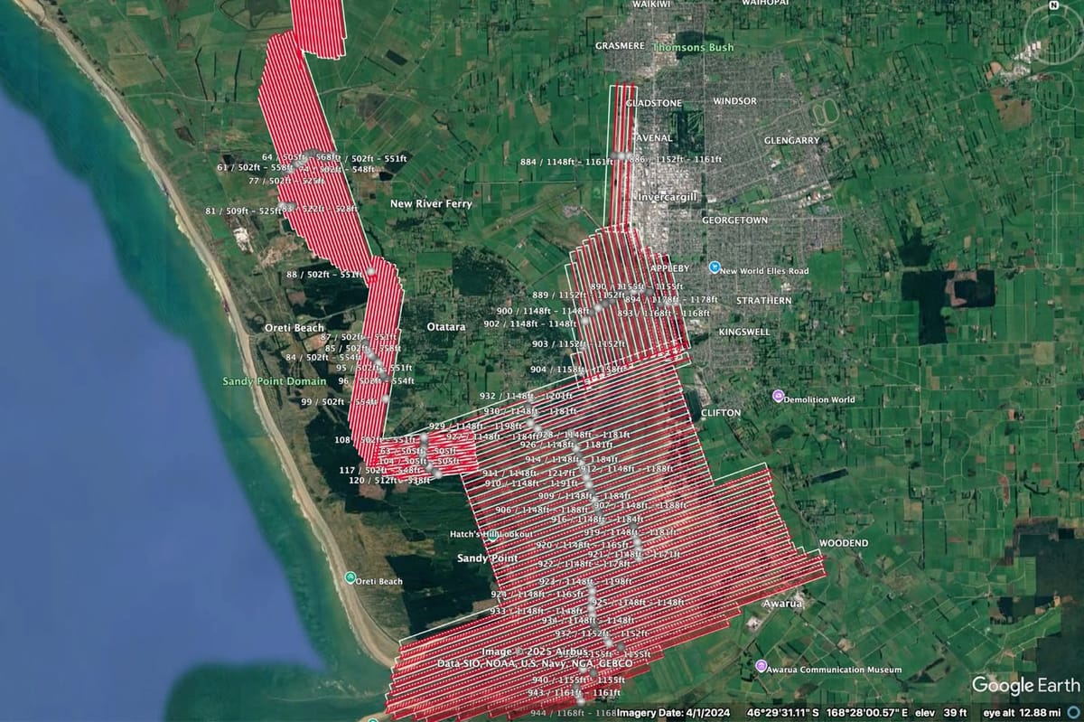
A low-flying helicopter will be seen over parts of Southland in the coming weeks as part of an environmental mapping project. The aircraft will operate across the Oreti and Aparima river catchments, capturing detailed elevation data of riverbeds and estuaries.
The work uses Bathymetric LiDAR technology, which measures the shape and depth of water bodies to produce high-resolution 3D maps. These maps are useful for environmental monitoring, marine research, and planning for natural hazards such as tsunamis.
The Airbus EC120B helicopter, registered as ZK-HPM, will fly at about 550 feet and around 70 knots. Most flights will take place around low tide for estuarine areas and at various times over the rivers. Some routes fall within Invercargill’s controlled airspace, and all flights have been cleared and coordinated to ensure safety.
This survey is a joint project between Christchurch Helicopters Ltd and VADIS Geomatics, a specialist mapping company owned by Christchurch Helicopters. It follows similar aerial mapping work already carried out between Riverton and Waituna Lagoon.
The project is being led by Land Information New Zealand. The data collected will be made freely available later this year through the LINZ Data Service. Once released, it will support research into the coastal environment and help with habitat mapping and modelling of potential coastal flooding events.