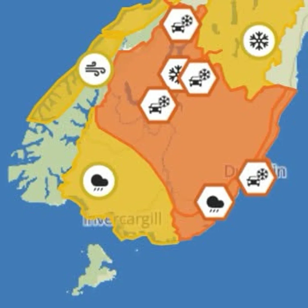
A heavy snow warning is in place for inland Otago and northern Southland from Sunday morning, with MetService warning accumulations could exceed a metre above 800 metres altitude.
The orange-level warning runs for 21 hours from 9am Sunday to 6am Monday. Snow is expected to develop Sunday morning, with the snowline dropping through the day — possibly down to 200 metres in places. Between 400 and 600 metres, 15 to 30 centimetres is forecast, particularly south of Queenstown through to Middlemarch. MetService has flagged a moderate chance of upgrading the warning to red.
Coastal Southland is not included in the snow warning but is under a separate heavy rain watch. Mainland Southland — excluding northern Southland above 400 metres — faces periods of heavy rain from 9am to 11pm Sunday, with accumulations potentially reaching warning levels. That watch also carries a moderate chance of upgrade.
The system driving all of this is a strong, cold southeast flow building over the lower South Island tonight and persisting into Monday and Tuesday. Heavy rain is also likely for low-lying parts of Otago — especially Dunedin and Clutha — as well as inland north Canterbury and Marlborough.
Fiordland north of Doubtful Sound is under a strong wind watch from 10pm Sunday to 6pm Monday. Southeast winds may approach severe gale in exposed places, again with a moderate chance of a formal warning being issued.
For anyone needing to travel through the inland Otago ranges this weekend, the advice is blunt: snow chains, sleeping bags, warm clothing, and emergency supplies. Power outages are possible, and cold stress to livestock is a real concern for rural properties in affected areas.
MetService is advising people to keep up to date with the latest forecasts as conditions develop.